The Pacific Coast Highway is the most spectacular road trip in California and one of the greatest drives in the world. Running along Route 1 from Los Angeles to San Francisco, it delivers 400 miles of dramatic coastal scenery — rugged cliffs dropping into the Pacific, elephant seal colonies lounging on beaches, the misty grandeur of Big Sur, and charming coastal towns that feel untouched by modern life.
The Route: South to North vs North to South
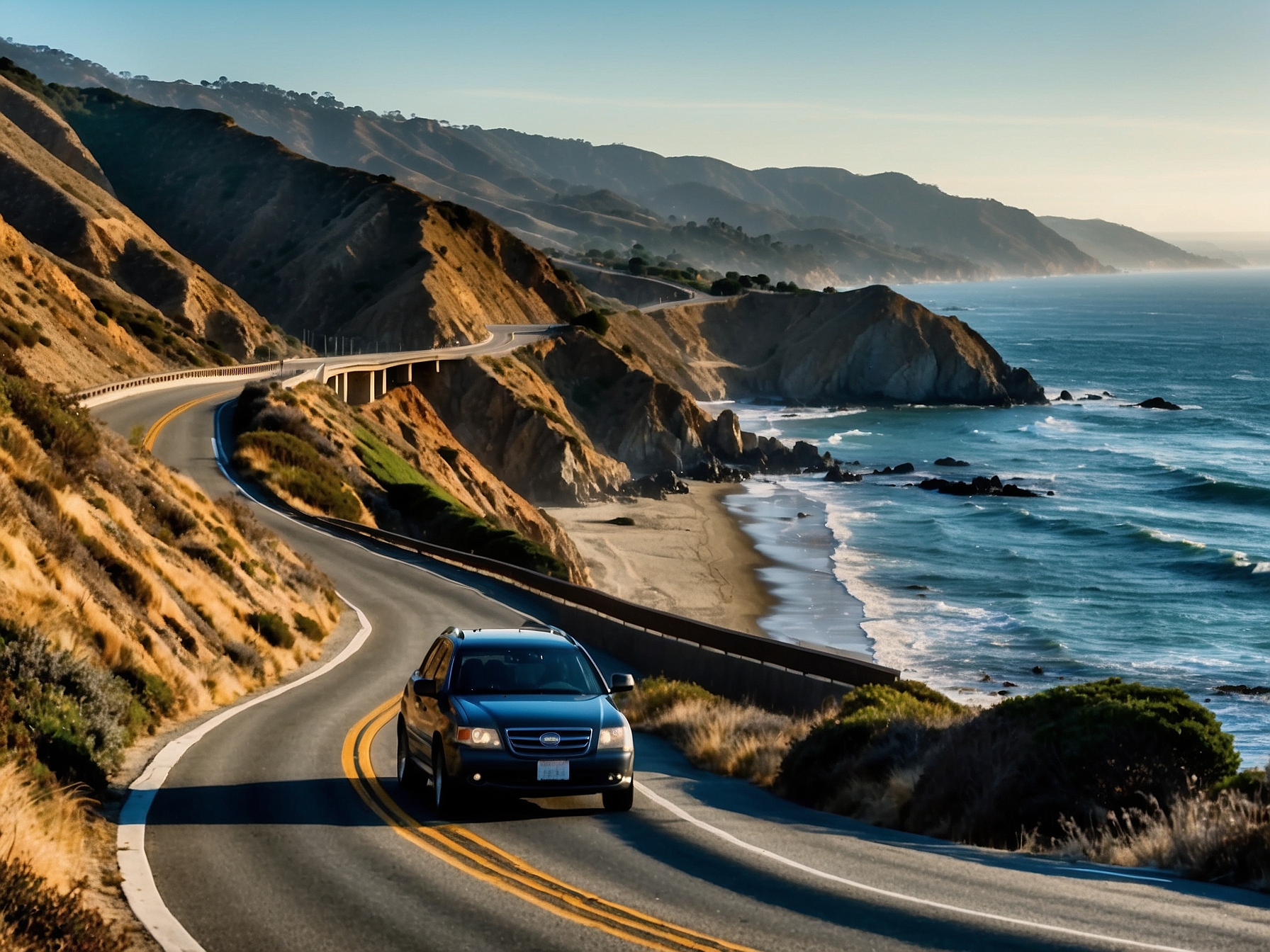
Most travelers drive the PCH from south to north — Los Angeles to San Francisco — because it keeps the ocean on the right side of the car, putting passengers closer to the views and making roadside pull-outs easier to access safely. The drive is divided naturally into three sections: the Southern California stretch from LA through Malibu and Santa Barbara, the Central Coast through Pismo Beach and San Luis Obispo, and the magnificent Big Sur section through Monterey and Carmel to San Francisco. Each section has a distinct personality and warrants at least one overnight stop.
Best Stops South of Big Sur
El Matador State Beach in Malibu is one of California's most beautiful beaches — sea caves, rock arches, and golden cliffs above a secluded cove. Santa Barbara deserves half a day minimum: walk State Street, visit the 1786 Spanish mission, and have lunch at the Santa Barbara Public Market. Pismo Beach is a classic Central Coast beach town with excellent seafood; in winter (October–February), a eucalyptus grove just north of town shelters millions of monarch butterflies in one of nature's most impressive seasonal events. San Luis Obispo has a fantastic Thursday night farmers market that takes over Higuera Street and is worth timing a visit around.
Book Pacific Coast Highway Drive Guide: California Route 1 Tours & Experiences
Skip the line · Free cancellation · Instant confirmation · Powered by Viator
Big Sur — The Heart of the Drive
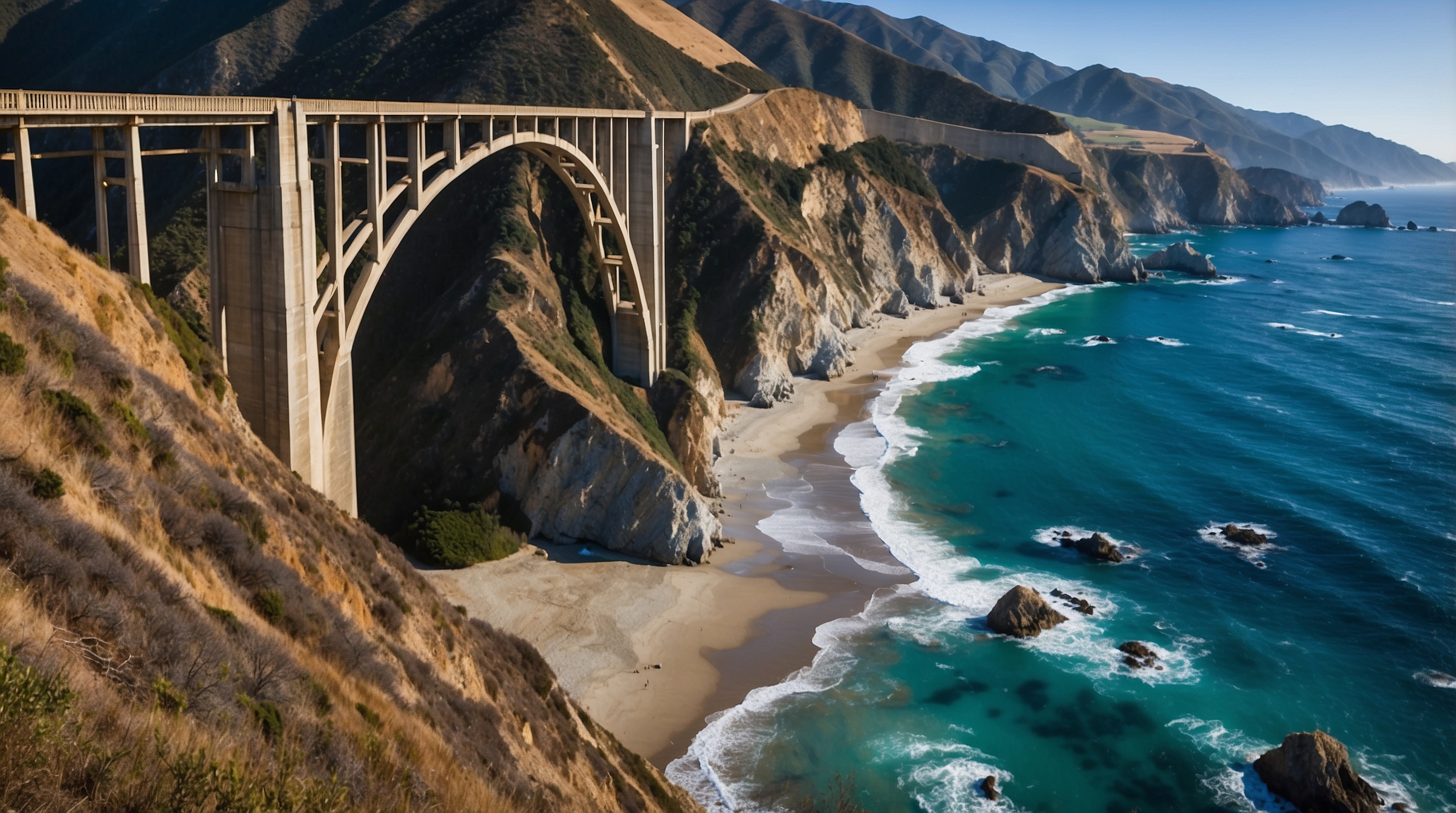
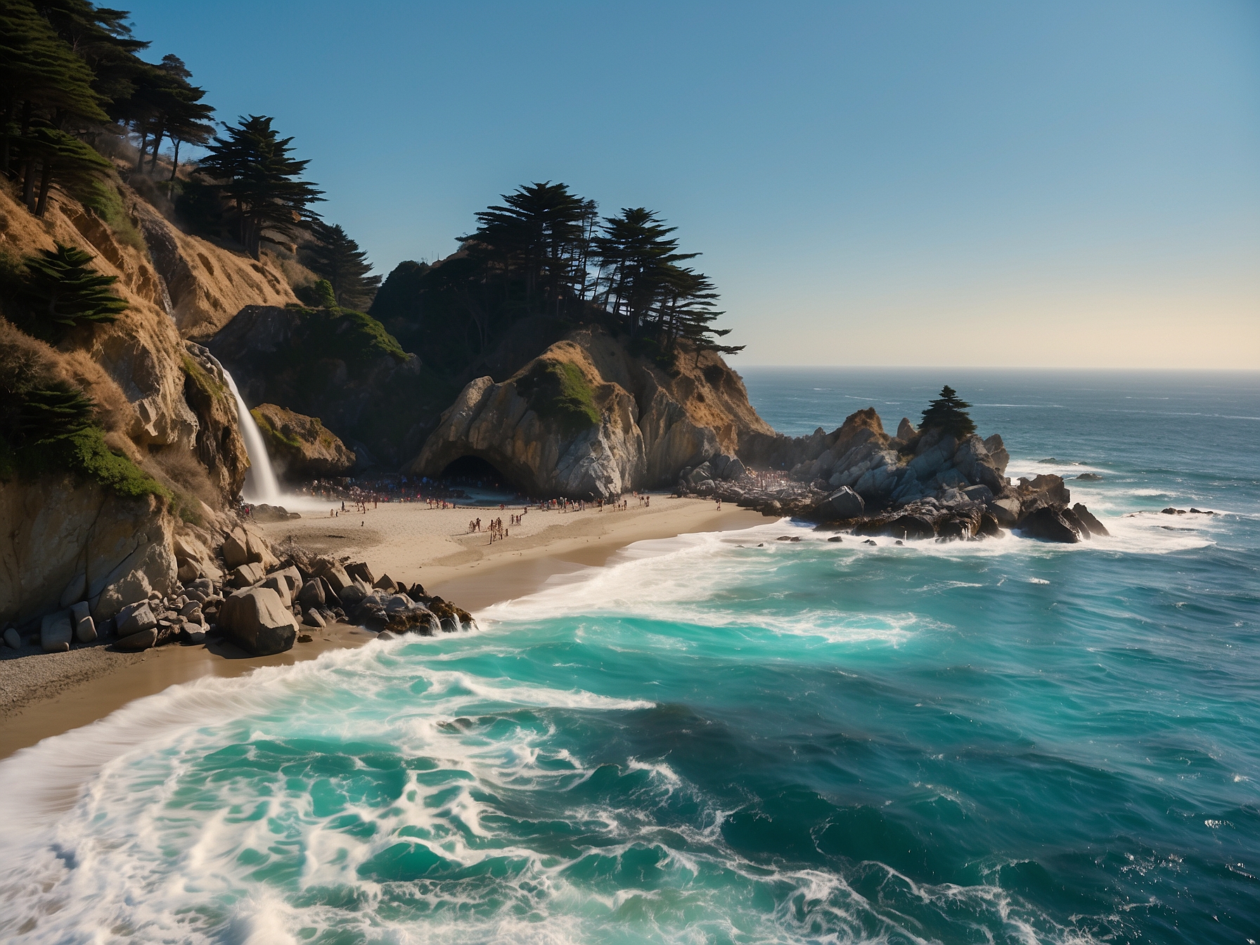
Big Sur is the undisputed highlight of the Pacific Coast Highway — 90 miles of some of the most dramatic coastal scenery on Earth, where the Santa Lucia Mountains plunge almost directly into the Pacific. Bixby Bridge, built in 1932, spans a 714-foot canyon and is the most photographed single point on the entire route — pull off at the north or south overlook for the classic shot. Julia Pfeiffer Burns State Park has the famous McWay Falls, an 80-foot waterfall that drops directly onto a beach accessible only by foot. Big Sur has virtually no cell service and very limited accommodation — book the Ventana Big Sur or Glen Oaks 3–6 months ahead.
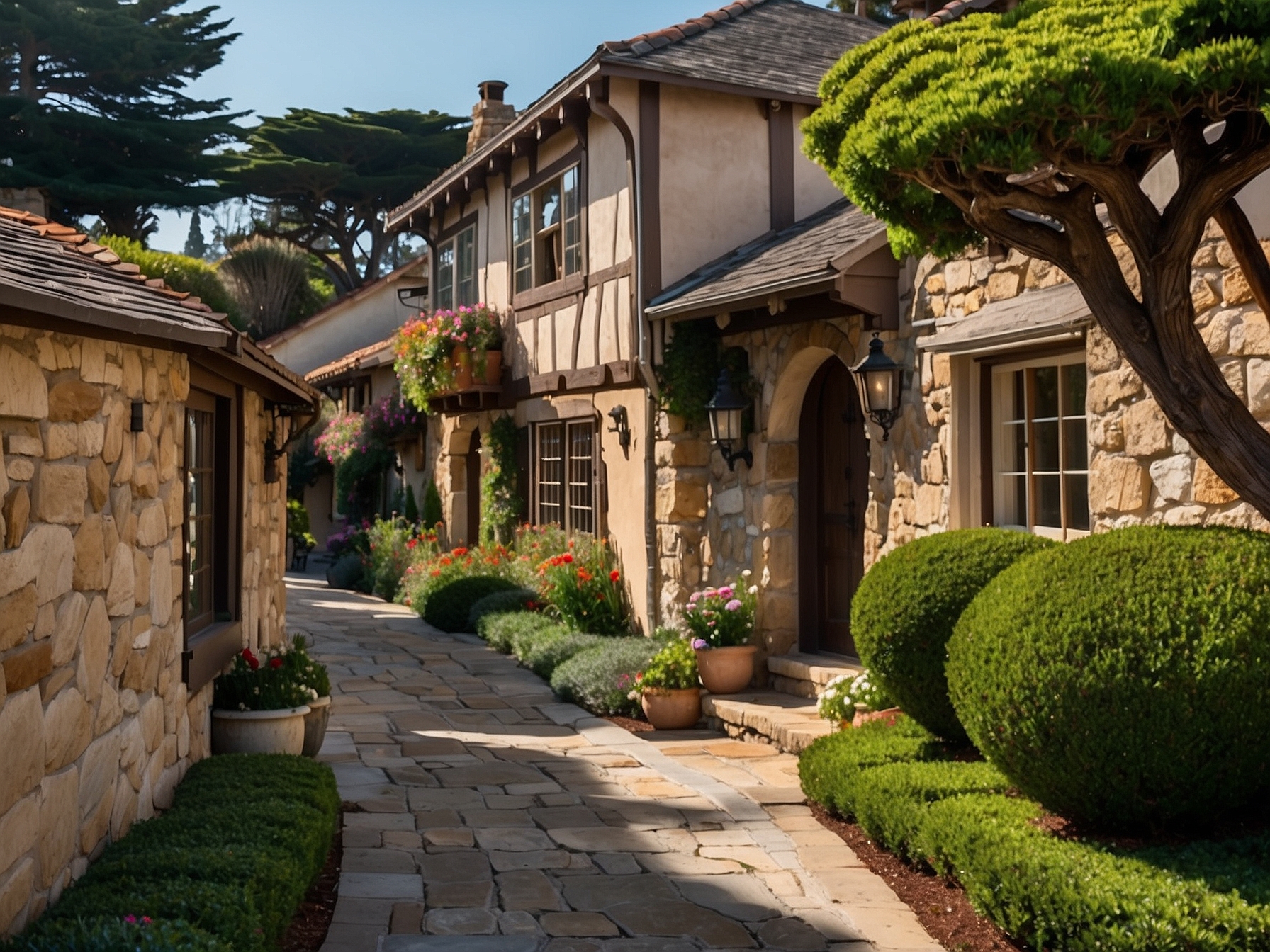
Monterey, Carmel & the 17-Mile Drive
Monterey's Cannery Row has been transformed from its Steinbeck-era sardine canneries into a tourist and restaurant district, but the Monterey Bay Aquarium remains one of the finest in the world. The 17-Mile Drive through Pebble Beach is a private scenic road ($11.25 per car) that passes the Lone Cypress and looks out over Pebble Beach Golf Links — worth every penny. Carmel-by-the-Sea immediately south is a fairy-tale village of stone-and-timber cottages, art galleries, and excellent restaurants within walking distance of a beautiful white-sand beach.
Practical Tips for Driving the PCH
Fill up your gas tank whenever you see a station in Big Sur — there are very few between Cambria and Carmel, and prices are high where they exist. Cell service disappears almost entirely through Big Sur; download offline maps before you start. Highway 1 through Big Sur can close without warning due to landslides — check Caltrans (511.org) for current conditions before heading into the section. Pull-out spots on the PCH can be competitive in summer; the best strategy is being on the road before 9 AM when morning fog often softens the light beautifully anyway.
Top Destinations


Find Hotels in United States
Compare hotels for your trip · Free cancellation · via Booking.com
Frequently Asked Questions
How long does it take to drive the Pacific Coast Highway?
The full PCH from Los Angeles to San Francisco is about 400 miles and takes roughly 8–9 hours of pure driving. Most travelers allow 3–5 days to do it justice, stopping at beaches, viewpoints, and towns along the way. Driving south to north (LA to SF) keeps the ocean on your right side — closer for photos and pull-outs.
What are the best stops on the Pacific Coast Highway?
Must-stop highlights include: Malibu's El Matador State Beach (sea caves), Santa Barbara (mission and State Street), Pismo Beach (monarch butterfly grove in winter), Big Sur's Bixby Bridge (most photographed spot on the PCH), McWay Falls (waterfall onto a beach), Carmel-by-the-Sea (charming village), and Monterey's 17-Mile Drive.
When is the best time to drive the Pacific Coast Highway?
Spring (April–May) and fall (September–October) offer the best conditions — clear skies, mild temperatures, and less traffic than summer. Summer fog is real on the PCH, especially in the morning between LA and Big Sur. August weekends bring heavy traffic on the coastal stretches near LA. January–February can bring slides that close sections of the road — check Caltrans conditions before driving.